Geoinformatics Club was established and started its activities on October 16, 2017, with the efforts of students of the Department of Geomatic Engineering and the support of academicians.
WHY IS THE CLUB NAMED GEOINFORMATİK?
80% of the data gathered from the Earth pertains to location, and presently, geometics engineers process this data to render it usable and interpretable. Consequently, the terms "geo," signifying place, and "informatics," denoting information, amalgamated to form the name of our club.
Mission;
Since its establishment, our club has aimed to enable its members to become engineers who actively examine and question the changing and developing technology in professional and social fields, are prone to multidisciplinary studies and can contribute to the needs of the age.
Vision;
Establishing the philosophy of lifelong learning as the principal objective,
Building the future by drawing strength from the knowledge and experiences we have garnered from the past,
To become a student club that advocates for cooperation and solidarity across all domains, both nationally and internationally
.
Our Activities;
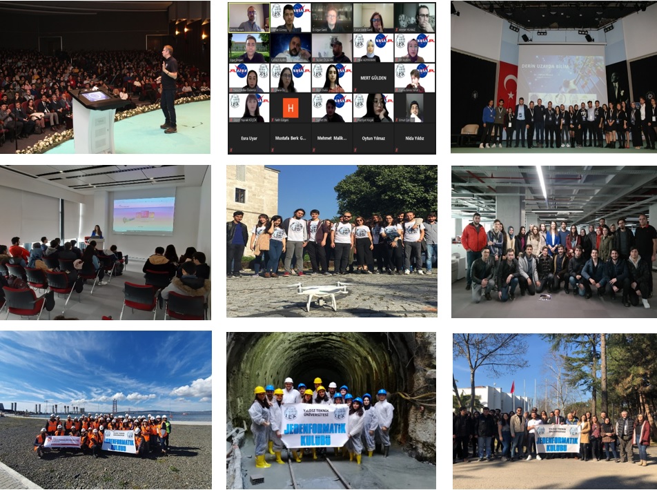
Since its inception, JEK has annually arranged an Introductory Breakfast with its members and introductory meetings with the Civil Engineering Students Community (HKMO). As part of our technical excursions, we have visited various sites including İSKİ (Istanbul Water and Sewerage Administration), GIS Directorate, General Directorate of Land Registry and Cadastre, ongoing construction sites for roads, bridges, metro lines, and more. Prior to the pandemic, we also organized a technical visit to the construction site of the 1915 Çanakkale Bridge and Highway Project.
Main events held online in the 2020-21 period;
• Becoming an Engineer at NASA (Dr. Emre HAVAZLI NASA/JPL)
• Science Expedition: ANTARCTICA (Doç. Dr. Burcu ÖZSOY)
• The Role of Geomatic Engineering in Earthquake Research (BOU-KRADE)
• General Command of Mapping in National Projects
• Spatial Data and GIS Applications (IMM GIS General Directorate)
It has been a full and successful year with almost twenty events, including over 40 guest speakers, more than 3 training sessions, and attracting over 2000 participants in total.
Contact Group:
YTU Surveying Engineering Group Website
Guidelines for Using the YTU Surveying Engineering Group:
• Discussions should be of interest to the majority of the group.
• Personal opinions regarding a discussion topic should be conveyed to the discussion owner via private email.
• If a professional topic being discussed involves a problem shared by multiple individuals, consider creating a blog post about the issue.
• Remember that academic staff members read group correspondences. Therefore, discussions should be conducted using formal language.
• Members should share responsibility with administrators for posts and files uploaded to the group. The quality and content of the group depend on this.
• Files uploaded to the group and discussion topics published should be retained in the group for a maximum of 10 days to avoid cluttering the system
YTU Surveying Engineering Group Objectives:
• Ensuring the group operates on behalf of the department.
• Conducting online surveys to better manage the group's members, announcing survey results to the group, making surveys a regular occurrence, and strengthening and improving the group's infrastructure based on survey results.
• Increasing the number of social and professional activities conducted with group members.
• Regular reporting of conducted activities.
• Ensuring the membership of YTU Surveying Engineering Department graduates in the group.
• Sending invitations to alumni with whom group members are in contact for membership,
• Publicizing the group through professional publications such as the Surveying Bulletin
Prof. Dr. Niyazi Arslan / Prof. Dr. Cüneyt Aydın
Open Topics for Contribution to the Site:
General information about Surveying Engineering recruitments and quotas in KPSS.
Information about private sector and contracted personnel recruitments.
Information about institutions employing surveying engineers and the work they do.
Information about scholarships (many of our friends have studied abroad with scholarships. They can share their experiences).
Internship and job postings.
Scholarship announcements.
Information about ERASMUS.
Information about symposiums.
Remote sensing.
Geographic information systems
Engineering surveys.
Exam results and lecture notes.
Interesting topics related to Surveying Engineering
Website Adresi : https://ytujek.com/ İnstagram Hesabı : instagram.com/jekytu Twitter Hesabı : twitter.com/jekytu Linkedin Hesabı : https://www.linkedin.com/company/jekytu/ |